dClimate Collaborates with AWS to Bring TESSERA's Global Land Intelligence to the World
Powered by AWS, dClimate will open the first freely available, analysis-ready record of how every 10 meters of Earth is changing
NEW YORK — Sept. 17, 2026 — dClimate today announced a collaboration with Amazon Web Services (AWS) to bring TESSERA — the global geospatial AI foundation model behind EarthOS and its land intelligence platform — to worldwide coverage and make its data freely available to everyone. Through the Amazon Sustainability Data Initiative (ASDI) and the AWS Open Data Sponsorship Program, AWS is providing compute credits and Open Data hosting to complete TESSERA's historical global embeddings and host the resulting analysis-ready data for open public access.
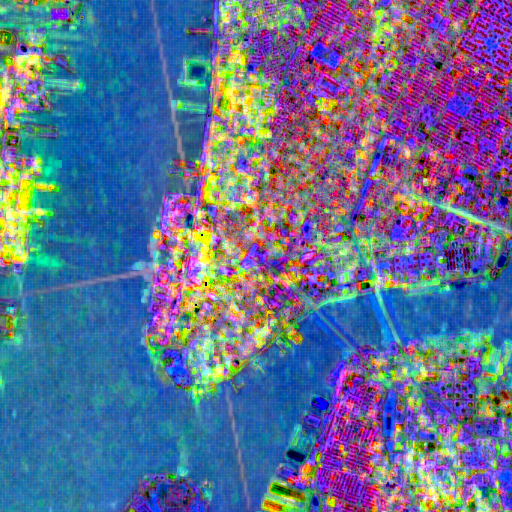
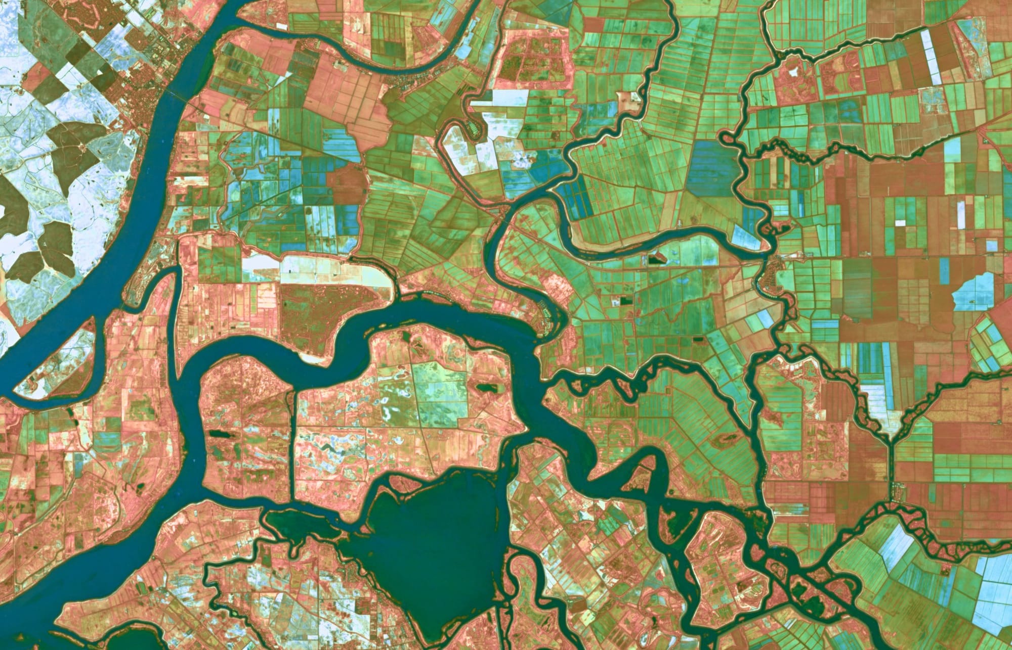
TESSERA, detailed in a peer-reviewed paper, was developed by Dr. Clement Atzberger, Chief Scientist at Arbol Inc., an AI-native insurance and climate risk company, in collaboration with researchers at the University of Cambridge. Arbol has served as an open source collaborator throughout TESSERA’s development, contributing applied research, engineering support, and real-world validation drawn from its climate risk underwriting, and backing the model’s release under an open license as a shared scientific resource. A pioneer in remote sensing, Dr. Atzberger and the Cambridge team designed TESSERA to solve a problem that has long held back environmental science: the world is continuously observed by satellites, yet turning that flood of raw imagery into something usable has remained slow, costly, and out of reach for most. TESSERA changes that by converting raw data from Europe's Sentinel-1 (radar) and Sentinel-2 (optical) missions into compact, analysis-ready "embeddings" - a distilled fingerprint that captures how every 10-meter patch of land on Earth changes over the course of a year.
The result is a continuously updated, machine-readable map of the planet's surface. Instead of managing petabytes of irregular, cloud-corrupted scenes, a researcher, conservationist, or developer can download lightweight 128-dimensional data layers and immediately begin asking questions about a forest, a watershed, a farm, or an entire continent.
"What Dr. Atzberger and his collaborators at the University of Cambridge have built, and what our team has since helped advance, is nothing less than a living, machine-readable map of how the Earth's surface is changing - every field, forest, and watershed, anywhere on Earth, year after year. With AWS, we're making it free and open to everyone: the farmer deciding how to steward her soil, the scientist tracking a shrinking forest, the community on the front lines of a changing climate. Our belief is simple: the data that describes our shared planet should be a public good, not a private moat. When everyone can see how the Earth is changing, everyone can help protect it."
— Osho Jha, Co-Founder and CEO, dClimate
What this unlocks
Completing and opening TESSERA's full historical record is the heart of this effort. Most environmental questions, such as carbon increases or decreases, forest size changes or cropland stress levels, can only be answered by comparing one year to the next, consistently and at scale. That kind of comparable, global, multi-year record has never been freely available, but with the launch of TESSERA:
- Climate and conservation researchers can track deforestation, biodiversity loss, and ecosystem change anywhere on Earth, including in regions that have historically lacked monitoring.
- Farmers, agronomists, and food companies can assess soil health, crop condition, and yield without costly fieldwork, supporting more resilient and productive agriculture.
- Carbon and restoration projects can verify outcomes with high-resolution, independent evidence, bringing transparency to a market that badly needs it.
- Insurers, lenders, and public institutions can understand and price land and climate risk with a clarity that simply hasn't existed before.
- Developers and entrepreneurs can build entirely new applications on top of an open, analysis-ready foundation, without the cost barrier that has limited accessibility to Earth observation.
By reducing the cost and complexity required to process satellite data by orders of magnitude, TESSERA is intended to do for Earth observation what open data has done for genomics and astronomy: turn a specialized, resource-intensive field into a shared platform that anyone can build on.
"The bottleneck in Earth observation has never been satellites — it's been the cost and complexity of turning raw imagery into something a scientist or developer can actually use. TESSERA clears that bottleneck. By making a decade of analysis-ready, 10-meter embeddings freely available on AWS, we're collapsing the infrastructure burden that has kept advanced Earth observation out of reach for most organizations. We're proud to host it."
— Chris Stoner, Geospatial Lead, AWS Open Data
Applied use in insurance and risk modeling
TESSERA is already in applied use by Arbol to develop climate insurance products for underserved regions where traditional insurers are retreating, and where limited data availability and modeling capabilities have long made these risks difficult or impossible to underwrite. By converting years of satellite observation into consistent, analysis-ready signals for every 10-meter patch of land, TESSERA helps underwriters structure and price coverage for perils including drought, flood, wildfire, and crop failure in markets that have historically gone unprotected. Making the underlying data openly available is expected to extend such applications worldwide.
Unlike proprietary alternatives, TESSERA is designed to be open by default. Its code and embeddings are released under an open license, with a public registry supporting reproducibility and independent verification. It is intended to function as a public utility for understanding the planet rather than a closed product.
About dClimate
dClimate is a climate intelligence company building AI-powered infrastructure to help the world measure, understand, and manage climate risk. Through its suite of platforms — including EarthOS, the world’s first self-supervised digital twin of Earth — dClimate transforms vast amounts of satellite, IoT, and environmental data into actionable insights for businesses, investors, and governments. dClimate’s solutions support applications across natural capital and carbon markets, climate risk and insurance, commodities, and supply chain resilience, enabling more transparent, data-driven, and science-based climate decisions. dClimate operates globally and partners with leading institutions across finance, agriculture, energy, and sustainability.
Learn more at dclimate.net
About the AWS Open Data program
AWS Open Data program allows researchers, analysts, and developers to access and analyze vast amounts of data without the burden of storage and transfer costs. It democratizes access to important datasets, fostering innovation across various fields. Learn more at: https://aws.amazon.com/opendata/
How it works and how to start using it: https://blog.dclimate.net/p/38e49e93-9b99-4fa2-a20a-11f034a5b43b/
Get the data on AWS: https://registry.opendata.aws/tessera/
Python client: https://geotessera.org/docs
Open source repo: https://github.com/dClimate/tessera-embeddings
Peer-reviewed paper: TESSERA: Temporal Embeddings of Surface Spectra for Earth Representation and Analysis
