
Data ReFined #30: International Collaboration in the VCM, Guidelines for Carbon Buyers, Deforestation-free Coffee

The Newsletter about Climate Data, Regenerative Finance, and Climate Risk ⛅
Thanks for tuning in to the latest issue of dClimate's biweekly newsletter. As always, we have handpicked several high-signal articles to keep you up-to-date with developments in the voluntary carbon markets, climate-related financial risks, and data-driven climate science.
In this edition, we'd like to draw special attention to our latest article on global coordination efforts to scale carbon financing and the new guidelines from the International Emissions Trading Association (IETA) for corporate buyers of carbon credits.
Keep scrolling to catch all the news! 👇
Subscribe here for more updates!
Industry News

International Cooperation in Carbon Markets
The voluntary carbon market (VCM) is an essential mechanism for financing on-the-ground climate action. In our latest article, we explore how Article 6 of the Paris Agreement, the Carbon Offsetting and Reduction Scheme for International Aviation (CORSIA), as well as global frameworks for monitoring, reporting, and verification, help to scale the VCM.
Read our blog post below for more details! 🙏
 dClimate
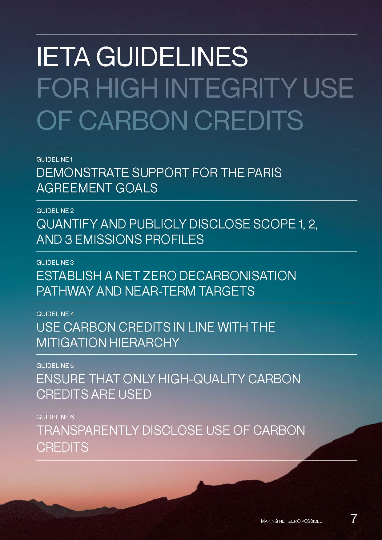
New IETA Guidelines for Corporate Carbon Buyers
At the European Climate Summit in Florence, the International Emissions Trading Association (IETA) introduced a paper offering guidance for corporate buyers on using carbon credits with high integrity and in alignment with the Paris Agreement goals.
Please find the official press release here.
Neutral Lists Biochar Carbon Credits
Neutral, an exchange for environmental assets, has listed CHAR biochar credits on its platform. This integration aims to advance carbon removal markets by providing a regulated and transparent trading environment, which helps to improve trust and accessibility of using high-quality carbon credits in corporate net-zero strategies.
 Neutral TeamApr 17, 2024·3min read

Insurance for Coastal Communities
Arbol has launched Lilypad Insurance, an initiative to serve the specific needs of homeowners in coastal areas. Lilypad aims to fill the coverage gaps left by insurers retreating from high-risk regions like Florida, California, and Louisiana, expanding the use of parametric insurance innovations for climate-related risks.


The Costs of Natural Catastrophes
Swiss Re's latest report highlights that natural disasters in 2023 caused $280 billion in economic losses globally. The reinsurer projects this trend will escalate, predicting an average annual growth in damages of 5-7% in real terms. This increase suggests that the current economic burden of climate-related damages could double within the next decade.

U.S. Hurricane Season Forecast
The 2024 Atlantic hurricane season is forecasted to be extremely active, according to the Colorado State University (CSU) hurricane forecasting team. They predict 23 named storms, 11 hurricanes, and five major hurricanes. Factors contributing to this prediction include warmer-than-average sea surface temperatures and a likely transition from El Niño to La Niña conditions.
 Jeff Masters
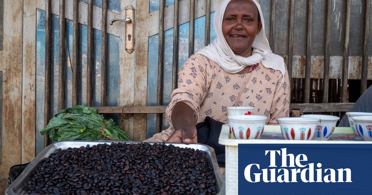
Deforestation-free Coffee
Ethiopian coffee growers face significant challenges due to the new EU Deforestation Regulation (EUDR), which requires proof that coffee beans do not come from deforested land. Due to the large number of smallholder farmers, there is a lack of expertise to work with the complex data needed to show compliance, which can potentially threaten Ethiopia's coffee exports and economic stability.
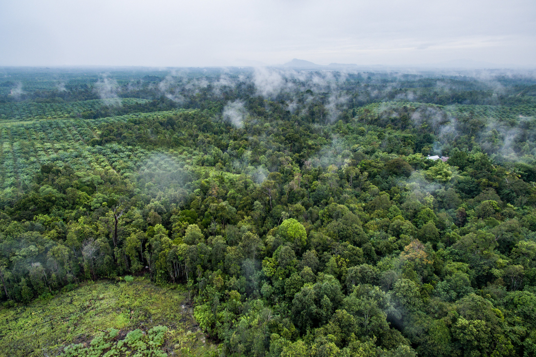
Tree Loss Data
New global tree cover loss datasets on Global Forest Watch indicate persistent rates despite declines in some countries. The data platform, enhanced by new algorithms and satellite capabilities, provides a nuanced view of forest changes as it distinguishes between various types of tree cover loss including deforestation, wildfires, and natural disturbances.
Check out the explainer article for more details.
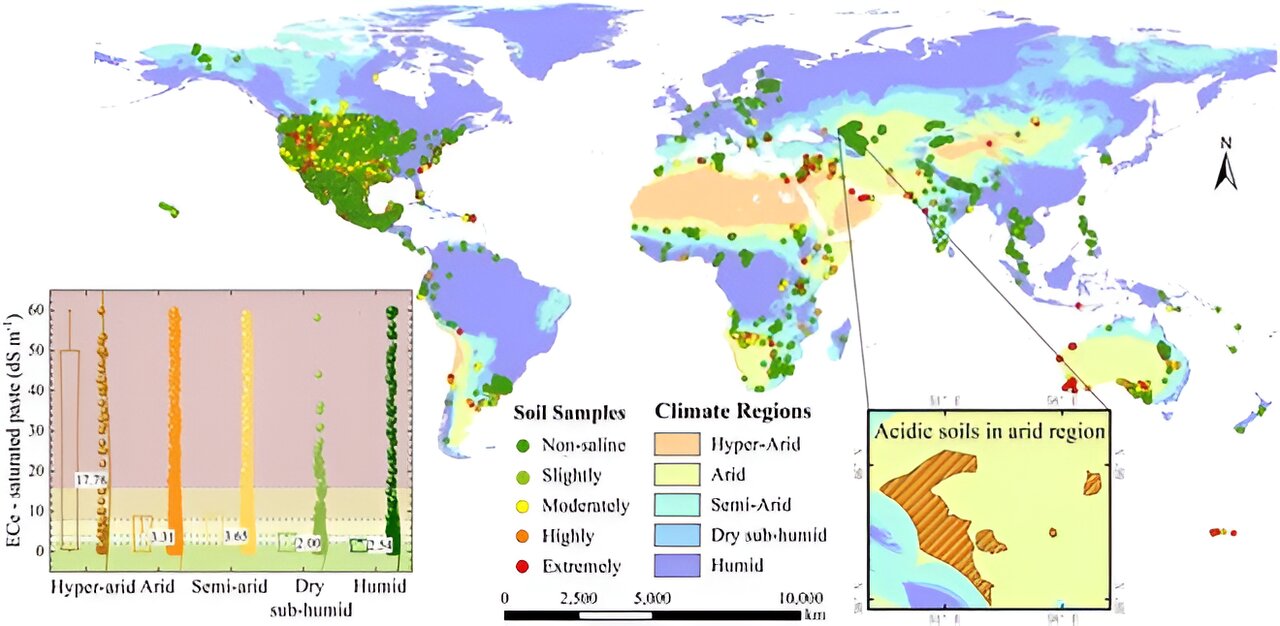
Using Remote Sensing Technologies for Soil Mapping
Researchers have developed a new method to map global soil salinity with 10-meter resolution, using a model that combines Sentinel-1/2 satellite images, climate data, terrain information, and machine learning algorithms. The high-resolution mapping offers crucial insights for sustainable land and agricultural practices, significantly advancing the capacity to manage and restore soil health globally.
Thank You For Reading Our Newsletter! 💙
Your interest and support mean a lot to us! If you enjoyed this content, please share this newsletter with your network to increase awareness of these important subjects.
Please join the conversation on social media, where we welcome your likes and comments! 👇
Connect with us on Twitter | LinkedIn | Discord | Telegram | YouTube
Learn more about the decentralized and open climate data ecosystem we are building via the links below!
🌐 Visit our website
👉 Check out our products
💽 Explore 40+ TB of free climate data via our data marketplace and API